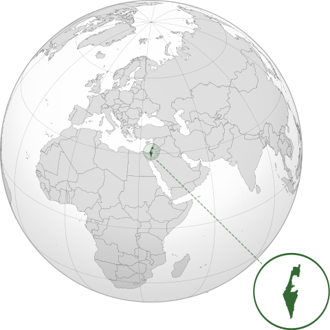
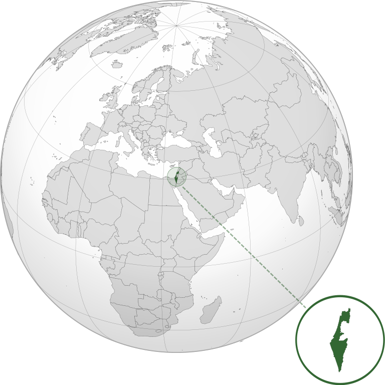
File:ISR orthographic.svg

Size of this PNG preview of this SVG file: 600 × 600 pixels. Otro resolushon: 240 × 240 pixels | 480 × 480 pixels | 768 × 768 pixels | 1,024 × 1,024 pixels | 2,048 × 2,048 pixels.
Fail original (Fail SVG, nominalmente 600x600 pixel, tamaño di fail: 1.39 MB)
Resúmen
| Deskripshon | |
| Fecha | |
| Fuente |
Obra propio with Natural Earth Data This W3C-unspecified vector image was created with Inkscape . |
| Outor | Addicted04 |
Lisensia
I, the copyright holder of this work, hereby publish it under the following license:
E fail akí tin lisensia Creative Commons Attribution-Share Alike 3.0 Unported.
- Bo ta liber:
- pa kompartí – pa kopia, distribuí i transmití e obra
- pa rekombiná – pa adaptá e obra
- Di akuerdo ku e próksimo kondishonnan:
- atribushon – Bo mester duna krédito na e outor, duna un lenk na e lisensia, i indiká si a hasi kambio. Bo por hasi esei na kualke manera rasonabel, perono na manera ku por sugerí ku esun ku ta otorgá e lisensia ta respaldá abo òf bo uzo.
- kompartí meskos – Si bo meskla, transfrmáòf modifiká e obra bo mester distribuí bo kontribushonnan bou di [mes lisensia https://creativecommons.org/share-your-work/licensing-considerations/compatible-licenses òf unu kompatibel] ku esun original.
Historia di fail
Klek riba un fecha/ora pa mira e fail, manera e tabata na e momentu ei.
| Fecha/Ora | Miniatura | Dimenshonnan | Usuario | Komentario | |
|---|---|---|---|---|---|
| aktual | 03:46, 17 mart 2022 | | 600 × 600 (1.39 MB) | Chaddy | Reverted to version as of 06:27, 24 March 2019 (UTC), there is already another map for the disputed borders: File:Israel (orthographic projection) with disputed territories.svg |
| 09:48, 10 mart 2022 |  | 600 × 600 (1.4 MB) | Beshogur | Reverted to version as of 06:25, 24 March 2019 (UTC) | |
| 06:27, 24 mart 2019 |  | 600 × 600 (1.39 MB) | BlueHypercane761 | Reverted to version as of 22:09, 21 September 2016 (UTC) Self-revert. As legitimate as this revision is, I will split it off into a new image file. | |
| 06:25, 24 mart 2019 |  | 600 × 600 (1.4 MB) | BlueHypercane761 | Restoring previous revision temporarily to retrieve image. | |
| 22:09, 21 sèptèmber 2016 |  | 600 × 600 (1.39 MB) | Nableezy | make a new map, this one is fine | |
| 18:50, 16 sèptèmber 2016 |  | 600 × 600 (1.4 MB) | Bolter21 | added disputed territories | |
| 03:06, 8 yüli 2012 |  | 600 × 600 (1.39 MB) | Addicted04 | America land | |
| 02:42, 8 yüli 2012 |  | 600 × 600 (1.39 MB) | Addicted04 |
_with_disputed_territories.svg)
Uso di fail
E próksimo page uses ta uza e fail akí:
Uso global di fail
E próksimo otro wikinan ta usa e fail akí
- Uso na af.wikipedia.org
- Uso na am.wikipedia.org
- Uso na arc.wikipedia.org
- Uso na av.wikipedia.org
- Uso na ay.wikipedia.org
- Uso na azb.wikipedia.org
- Uso na az.wiktionary.org
- Uso na ban.wikipedia.org
- Uso na bbc.wikipedia.org
- Uso na bcl.wikipedia.org
- Uso na bg.wikipedia.org
- Uso na bh.wikipedia.org
- Uso na bi.wikipedia.org
- Uso na bn.wikipedia.org
- Uso na bs.wikipedia.org
- Uso na bxr.wikipedia.org
- Uso na cdo.wikipedia.org
- Uso na ceb.wikipedia.org
- Uso na chr.wikipedia.org
- Uso na ckb.wikipedia.org
- Uso na cs.wikipedia.org
- Uso na da.wikipedia.org
- Uso na dty.wikipedia.org
- Uso na el.wikipedia.org
- Uso na en.wikipedia.org
- Uso na en.wikibooks.org
- Uso na es.wikipedia.org
- Uso na eu.wikipedia.org
- Uso na fi.wikipedia.org
- Uso na fr.wikipedia.org
- Uso na gn.wikipedia.org
- Uso na gu.wikipedia.org
- Uso na gv.wikipedia.org
- Uso na hak.wikipedia.org
- Uso na hr.wikipedia.org
- Uso na hy.wikipedia.org
- Uso na id.wikipedia.org
- Uso na ie.wikipedia.org
- Uso na incubator.wikimedia.org
Mira mas uzo global di e fail akí.