File:Lage der kreisfreien Stadt Bremen in Deutschland.gif
No tin resolushon mas mihó.
Lage_der_kreisfreien_Stadt_Bremen_in_Deutschland.gif (176 × 234 pixel, tamaño di fail: 3 KB, MIME type: image/gif)

|
This locator map image could be re-created using vector graphics as an SVG file. This has several advantages; see Commons:Media for cleanup for more information. If an SVG form of this image is available, please upload it and afterwards replace this template with
{{vector version available|new image name}}.
It is recommended to name the SVG file “Lage der kreisfreien Stadt Bremen in Deutschland.svg”—then the template Vector version available (or Vva) does not need the new image name parameter. |
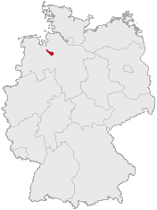
english:Location, City Bremen in Germany deutsch:Lage der kreisfreien Stadt Bremen in Deutschland
Svenska: Tyskland med Bremen markerat
Made by Geograv based on the data from:
This image was generated with OpenGeoDB. The information there is placed in the public domain, images generated from OpenGeoDB are derivative works without passing the threshold of creativity, they are therefore also public domain.
| This work is ineligible for copyright and therefore in the public domain because it consists entirely of information that is common property and contains no original authorship. |
Historia di fail
Klek riba un fecha/ora pa mira e fail, manera e tabata na e momentu ei.
| Fecha/Ora | Miniatura | Dimenshonnan | Usuario | Komentario | |
|---|---|---|---|---|---|
| aktual | 16:21, 10 yanüari 2005 | | 176 × 234 (3 KB) | Nordelch | Location, City Bremen in Germany {{GFDL}} |
Uso di fail
E próksimo page uses ta uza e fail akí:
Uso global di fail
E próksimo otro wikinan ta usa e fail akí
- Uso na de.wikipedia.org
- Uso na ext.wikipedia.org
- Uso na la.wikipedia.org
- Uso na nds.wikipedia.org
- Uso na oc.wikipedia.org
- Uso na pt.wikipedia.org
- Uso na sq.wikipedia.org
- Uso na sv.wikipedia.org
- Uso na uk.wikipedia.org