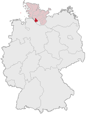
File:Lage des Kreises Pinneberg in Deutschland.png
Lage_des_Kreises_Pinneberg_in_Deutschland.png (176 × 234 pixel, tamaño di fail: 4 KB, MIME type: image/png)
Historia di fail
Klek riba un fecha/ora pa mira e fail, manera e tabata na e momentu ei.
| Fecha/Ora | Miniatura | Dimenshonnan | Usuario | Komentario | |
|---|---|---|---|---|---|
| aktual | 12:21, 5 aprel 2007 |  | 176 × 234 (4 KB) | Ditschi | transparent |
| 09:19, 3 mart 2006 |  | 176 × 234 (4 KB) | Rauenstein | Karte erstellt auf der Grundlage der opengeodb.de-Umrisse - GNU-FDL Geograv 00:54, 31. Dez 2004 {{Bild-GFDL}} Category:Maps of Germany |
Uso di fail
E próksimo page uses ta uza e fail akí:
Uso global di fail
E próksimo otro wikinan ta usa e fail akí
- Uso na ace.wikipedia.org
- Uso na am.wikipedia.org
- Uso na ang.wikipedia.org
- Uso na arc.wikipedia.org
- Uso na av.wikipedia.org
- Uso na ay.wikipedia.org
- Uso na bcl.wikipedia.org
- Uso na bi.wikipedia.org
- Uso na bm.wikipedia.org
- Uso na bpy.wikipedia.org
- Uso na bxr.wikipedia.org
- Uso na cbk-zam.wikipedia.org
- Uso na ceb.wikipedia.org
- Uso na ch.wikipedia.org
- Uso na cr.wikipedia.org
- Uso na cs.wikipedia.org
- Uso na cu.wikipedia.org
- Uso na cv.wikipedia.org
- Uso na cy.wikipedia.org
- Uso na dsb.wikipedia.org
- Uso na dv.wikipedia.org
- Uso na dz.wikipedia.org
- Uso na eml.wikipedia.org
- Uso na eo.wikipedia.org
- Uso na es.wikipedia.org
- Uso na ext.wikipedia.org
- Uso na ff.wikipedia.org
- Uso na fiu-vro.wikipedia.org
- Uso na fj.wikipedia.org
- Uso na fo.wikipedia.org
- Uso na frp.wikipedia.org
- Uso na frr.wikipedia.org
- Uso na fr.wikipedia.org
- Uso na fur.wikipedia.org
- Uso na fy.wikipedia.org
- Uso na gag.wikipedia.org
- Uso na gn.wikipedia.org
- Uso na got.wikipedia.org
- Uso na hak.wikipedia.org
- Uso na haw.wikipedia.org
- Uso na hif.wikipedia.org
- Uso na hi.wikipedia.org
- Uso na hr.wikipedia.org
- Uso na ht.wikipedia.org
- Uso na hy.wikipedia.org
- Uso na id.wikipedia.org
- Uso na ie.wikipedia.org
Mira mas uzo global di e fail akí.
