File:Un-moldova.png
Fail original (2,057 × 2,580 pixel, tamaño di fail: 1.52 MB, MIME type: image/png)
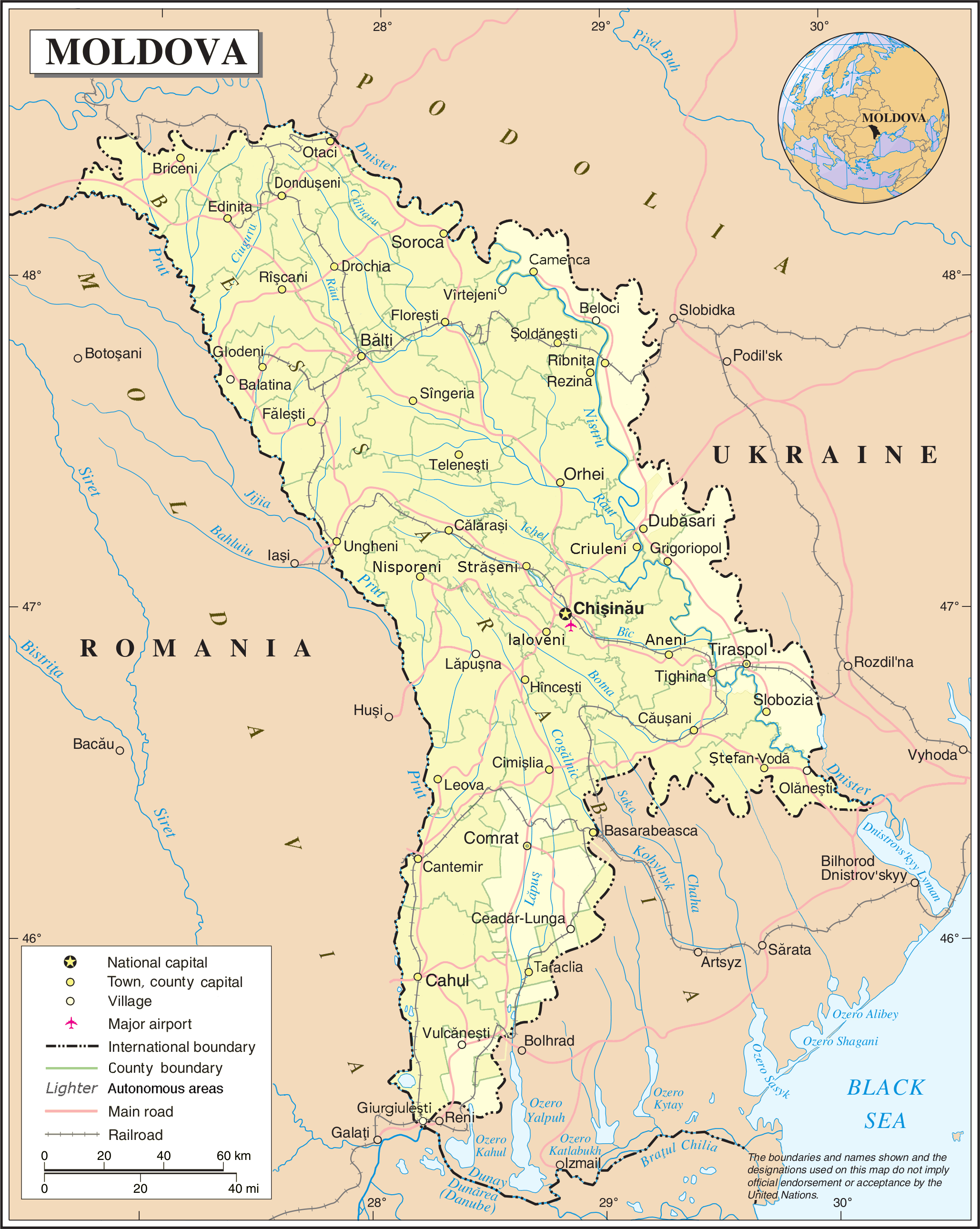
| This image is a map derived from a United Nations map.
Unless stated otherwise, UN maps are to be considered in the public domain. This applies worldwide. UN maps are, in principle, open source material and you can use them in your work or for making your own map. UN requests however that you delete the UN name, logo and reference number upon any modification to the map. Content of your map will be your responsibility. You can state in your publication, if you wish, something like: based on UN map … (map name, map number, revision number and date). See: Geospatial Information Section. And: Geospatial, location data for a better world. |
 |
Historia di fail
Klek riba un fecha/ora pa mira e fail, manera e tabata na e momentu ei.
| Fecha/Ora | Miniatura | Dimenshonnan | Usuario | Komentario | |
|---|---|---|---|---|---|
| aktual | 08:44, 5 yüni 2023 | | 2,057 × 2,580 (1.52 MB) | Moodylo333 | Update, spelling, counties (see discussion) |
| 01:31, 24 òktober 2007 |  | 2,057 × 2,580 (1.2 MB) | Jeroen | {{UN map}} Category:Maps of Moldova |
Uso di fail
E próksimo page uses ta uza e fail akí:
Uso global di fail
E próksimo otro wikinan ta usa e fail akí
- Uso na en.wikipedia.org
- Uso na fr.wikipedia.org
- Uso na hr.wikipedia.org
- Uso na nl.wikipedia.org
- Uso na pl.wiktionary.org
- Uso na rm.wikipedia.org
- Uso na uk.wiktionary.org
- Uso na www.wikidata.org