File:Un-nepal.png

Fail original (3,038 × 2,257 pixel, tamaño di fail: 1.56 MB, MIME type: image/png)
Resúmen
| Deskripshon |
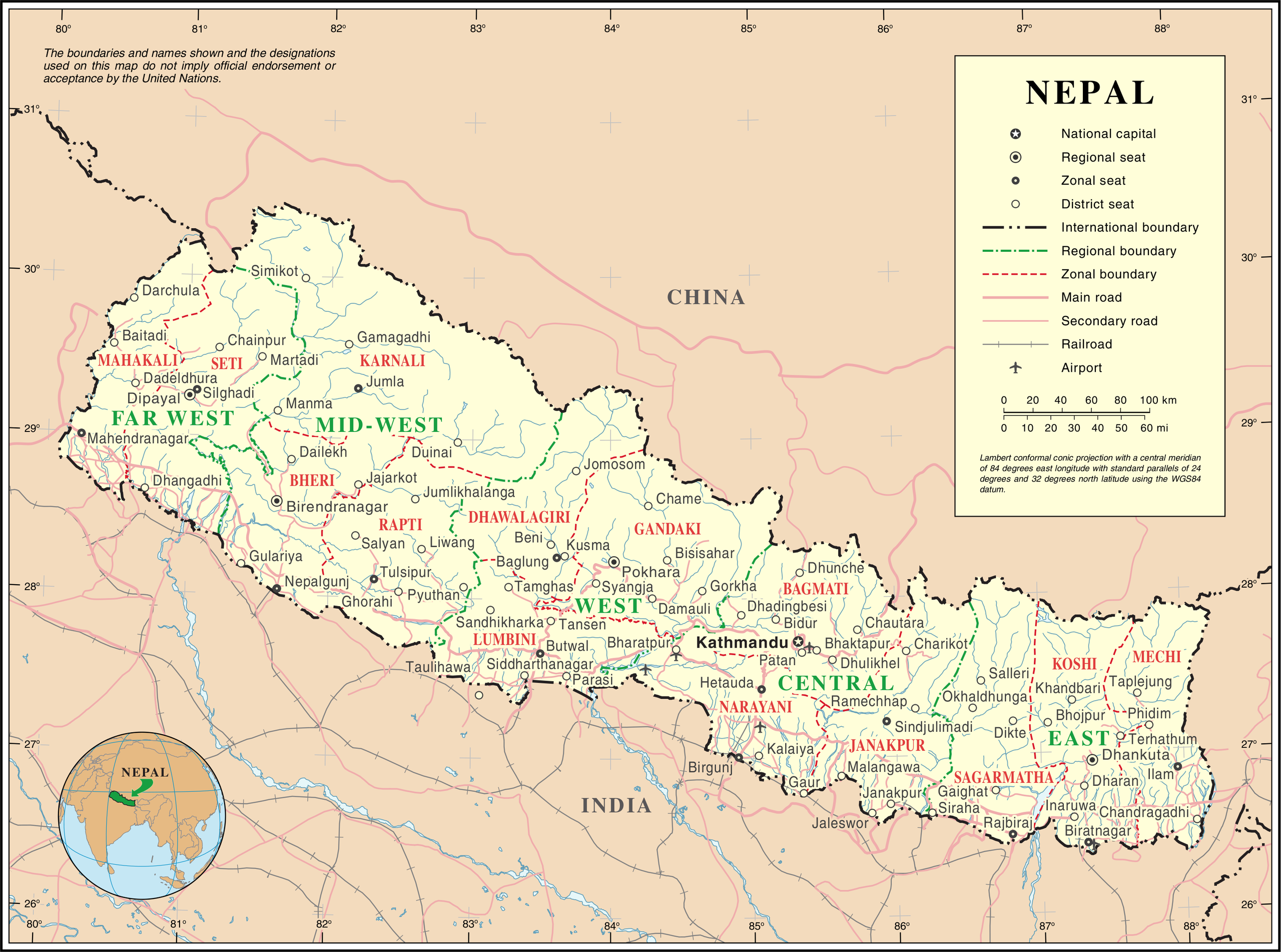
English: Map of Nepal highlighting development regions (green) and administrative zones (red), both disestablished in 2015 |
|||
| Fecha | before 25 òktober 2007 | |||
| Fuente | United Nations | |||
| Outor | Unknown author | |||
| Pèrmit (Ta re-utilisá e fail akí) |
|

Historia di fail
Klek riba un fecha/ora pa mira e fail, manera e tabata na e momentu ei.
| Fecha/Ora | Miniatura | Dimenshonnan | Usuario | Komentario | |
|---|---|---|---|---|---|
| aktual | 01:36, 24 òktober 2007 | | 3,038 × 2,257 (1.56 MB) | Jeroen | {{UN map}} Category:Maps of Nepal |
Uso di fail
E próksimo page uses ta uza e fail akí:
Uso global di fail
E próksimo otro wikinan ta usa e fail akí
- Uso na af.wikipedia.org
- Uso na az.wikipedia.org
- Uso na ba.wikipedia.org
- Uso na bh.wikipedia.org
- Uso na ca.wikipedia.org
- Uso na de.wikipedia.org
- Uso na en.wikipedia.org
- Uso na fi.wikipedia.org
- Uso na fr.wikipedia.org
- Uso na hyw.wikipedia.org
- Uso na ja.wikipedia.org
- Uso na krc.wikipedia.org
- Uso na nl.wikipedia.org
- Uso na pcd.wikipedia.org
- Uso na pl.wiktionary.org
- Uso na roa-rup.wikipedia.org
- Uso na ru.wikipedia.org
- Uso na sco.wikipedia.org
- Uso na sl.wikipedia.org
- Uso na ta.wikipedia.org
- Uso na th.wikipedia.org
- Uso na tr.wikipedia.org
- Uso na uk.wikipedia.org
- Uso na ur.wikipedia.org
- Uso na www.wikidata.org
- Uso na xmf.wikipedia.org